Looking back into history

by Tim Bondy
Mountain Home News
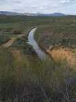
Most residents living in the Mountain Home area have likely seen the little sliver of water running along parts of Highway 20 between Windy Gap and Anderson Dam Road. That 15 to 20 foot wide body of water is called the Little Camas Canal.
The canal got its name from the body of water that feeds it -- Little Camas Reservoir northeast of Mountain Home. The recent five-year drought took its toll on the amount of water the reservoir has collected in it.
However, this year's heavier winter snowfall and rainy spring have rejuvenated both the pool of water in the reservoir and the amount of water flowing into the canal.
There is quite a history behind this canal system that flows out of the north face of the Little Camas Dam as it winds its way westward into a lesser known body of water called Long Tom Reservoir.
Both Little Camas and Long Tom Reservoirs, as well as the canal that connects the two bodies of water together, were constructed in the late 1800s as part of an original plan to irrigate up to 45,000 of agricultural land from the Boise Valley and eastward toward Gooding.
Today, the water in the reservoirs and canal system irrigate about 4,300 acres and 142 users.
According to long-time resident Calvin Ireland, all the canal work was completed by hand and by using work horses, probably around the early 1890s. While the canal suffered some blowouts and major leaks over time, the basic path of the current canal remains true to it historic path.
The canal, over most of its history, has been maintained by a local irrigation districts based out of the Mountain Home area. While Ireland wasn't completely sure about his facts, he thought there was only five or six different water masters managing the water, the canals and the district itself since the early 1900s.
"You can look through our archives to research the history of the canals and management of the district but it might take some time," Ireland said as he opened drawer after drawer of old yellowed documents.
A dusty two-track road follows along side most of the length of the canal, according to the Mountain Home Irrigation District's current watermaster Terry Seegrist. The road is used by district employees called ditch-riders. One of the many tasks assigned to a ditch-rider is to detect leaks, obstructions or damage to irrigation canals.
The few spots where the two-track road doesn't follow the canal is where the aqueduct flows into one of the four or five tunnels along its path. The shortest tunnel is about 50 feet, and the longest stretches more than 1,700 feet in length.
"Some of those tunnels were cut into the mountain by miners who travelled south from the northern Idaho gold mines when those miners went on strike in the late 1800s," said Mike Landers, a Mountain Home Irrigation District commissioner.
Ireland added that digging the tunnels was likely backbreaking work as all of the tunnels are less than six feet in height and some might be less than five feet high.
Once the canal water reaches Long Tom Reservoir, it's released when the need arises and then flows southward into the Mountain Home Reservoir just north of town.
